Over the years, the Remote Mapping Group has completed several challenging projects with different goals and specifications for our clients. Our goal is to complete projects safely, accurately, and on time.
Here are examples of the projects we have completed, with more to come.
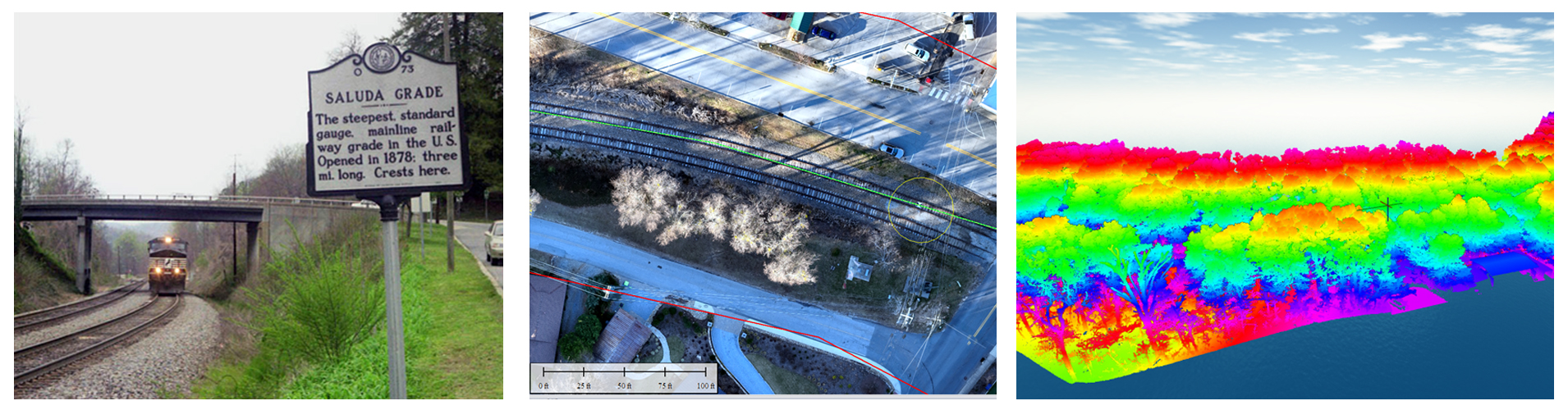
Using UAs LiDAR Technology to Help Engineering Firms map, design and plan the new Saluda Grade Trail North Carolina and South Carolina.