Using UAS LiDAR Technology to Help Engineering Firms map, design and plan the new Saluda Grade Trail NC-SC.
A local nonprofit finalized the purchase on June 17 of a 31.5-mile stretch of freight railroad, which it aims to convert into a mixed-use biking and walking trail. The planned trail would pass through Inman, Campobello, and Landrum, South Carolina, before crossing into North Carolina to go through Tryon, Saluda, and Zirconia, in Henderson and Polk counties. The Saluda Grade Trail Conservancy, a group formed for that purpose, bought the corridor from the freight rail company Norfolk Southern for $28.5 million, it announced on June 24.
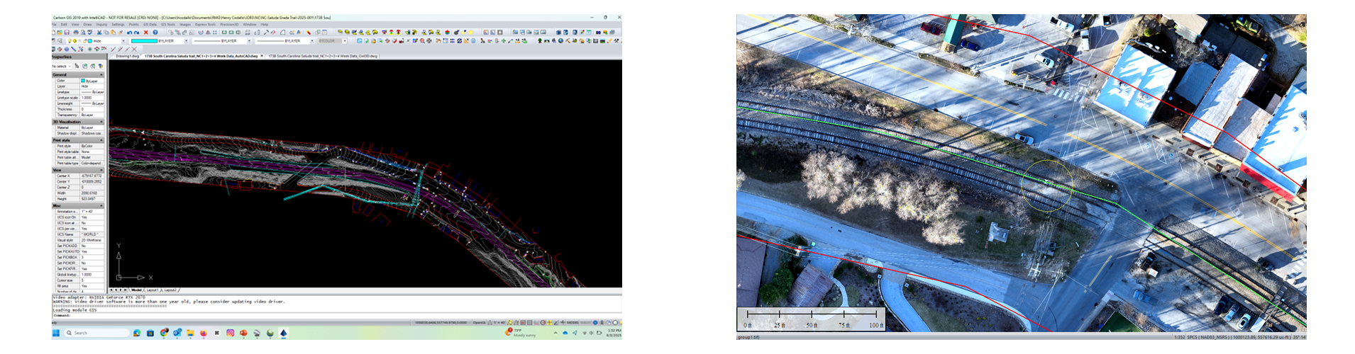
Our company, Remote Mapping Group LLC, won a contract to deliver rigorous and accurate geospatial data products like: 1 foot contour lines from UAS LiDAR, Orthophoto-mosaics from UAS Photogrammetry, GNSS-RTK survey control for targeting and check points, Data feature extraction in CAD files, DTM, QC/QA to meet the standards of the Land survey and mapping of each state and also of the ASPRS over this 31.5 miles, 200 ft corridor, 737 acres collected.
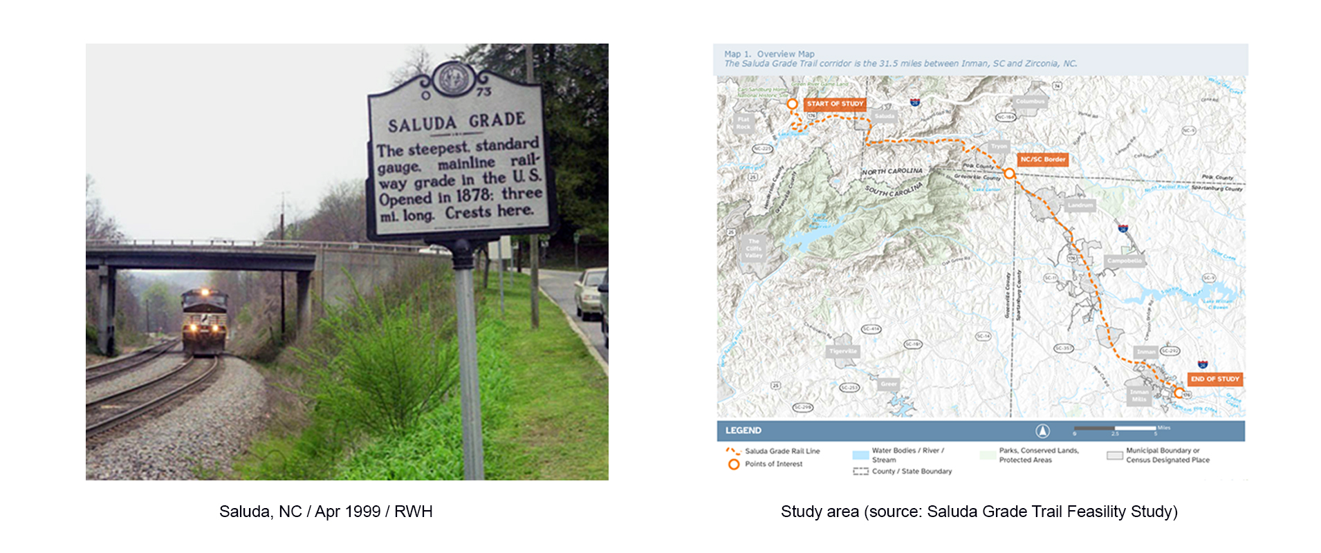
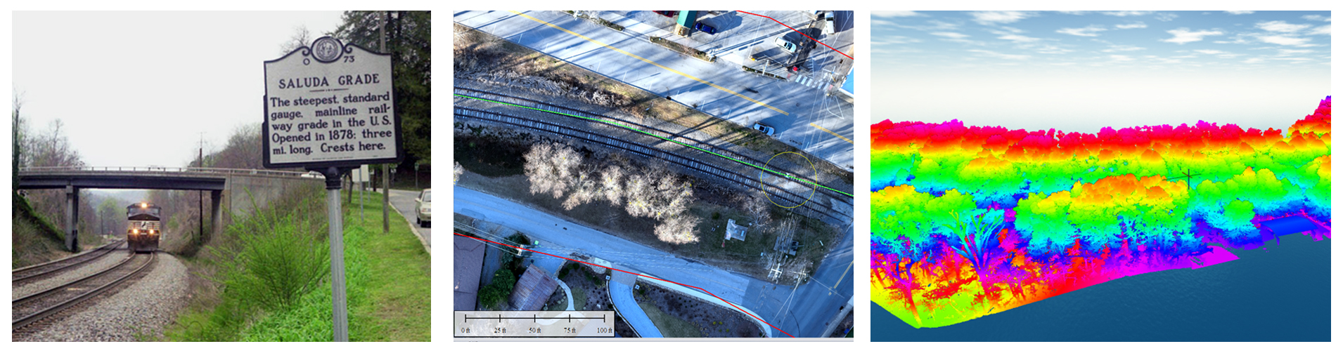
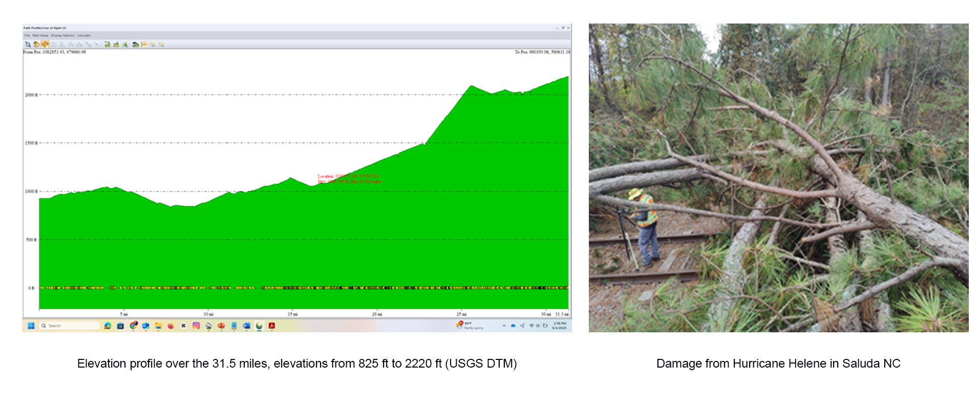
Saluda Grade in southwest North Carolina was the steepest standard-gauge mainline railway grade in the United States. The Saluda Grade Railroad was completed in 1878 and operated by the Southern Railway and later by Norfolk Southern, after Southern merged with the Norfolk and Western Railway (N & W). Norfolk stopped running trains on this line in 2001. As part of its W Line, Saluda Grade in Polk County gains 606 feet in elevation in less than three miles between Melrose and Saluda, North Carolina. The average grade is 4.24% over 2.6 miles, with a brief maximum of 4.9% for about 100 yards.
In September 2024, Hurricane Helene made landfall in North Carolina on Friday, September 27, bringing historic rainfall, strong winds, and tornadoes that caused devastating flooding in Saluda, NC's Green River Cove area, destroying numerous homes and businesses. The hurricane hit before the survey began.
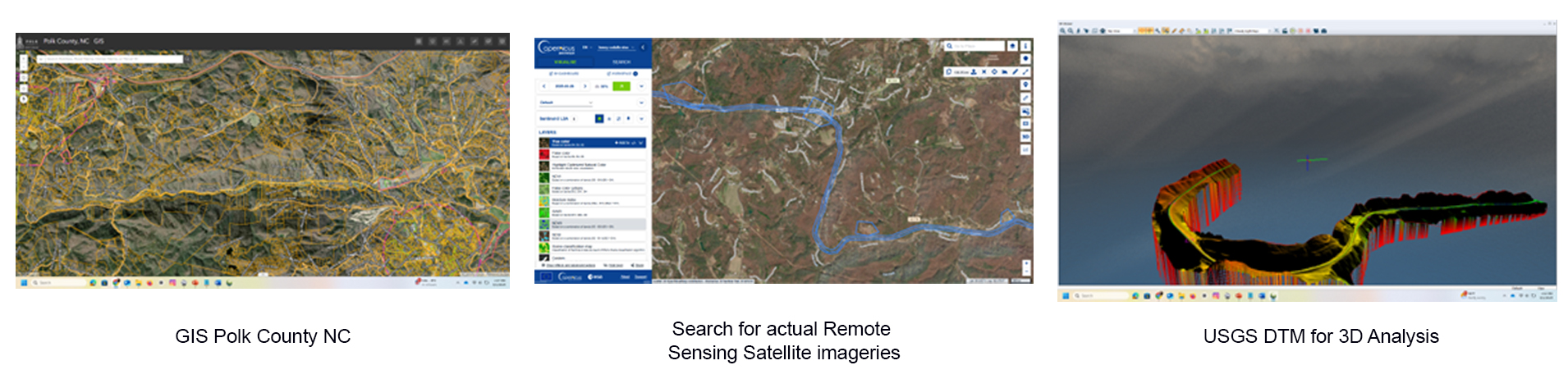
Due to the high challenge environment of the project, our expert staff combined tools and geospatial analyst techniques like: GIS of the counties, actual remote sensing satellite imageries of the area, USGS DTM for 3D Analysis, previous scouting of the area for search spots for set manlift and Fly safety, check FAA restrictions zones, to do the best and accurate planning of the GNSS survey and UAS LIDAR and Photogrammetry collecting, thus minimizing the risk and for the safety of the operations on field and the integrity of the data.
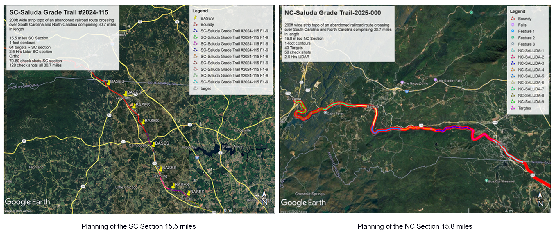
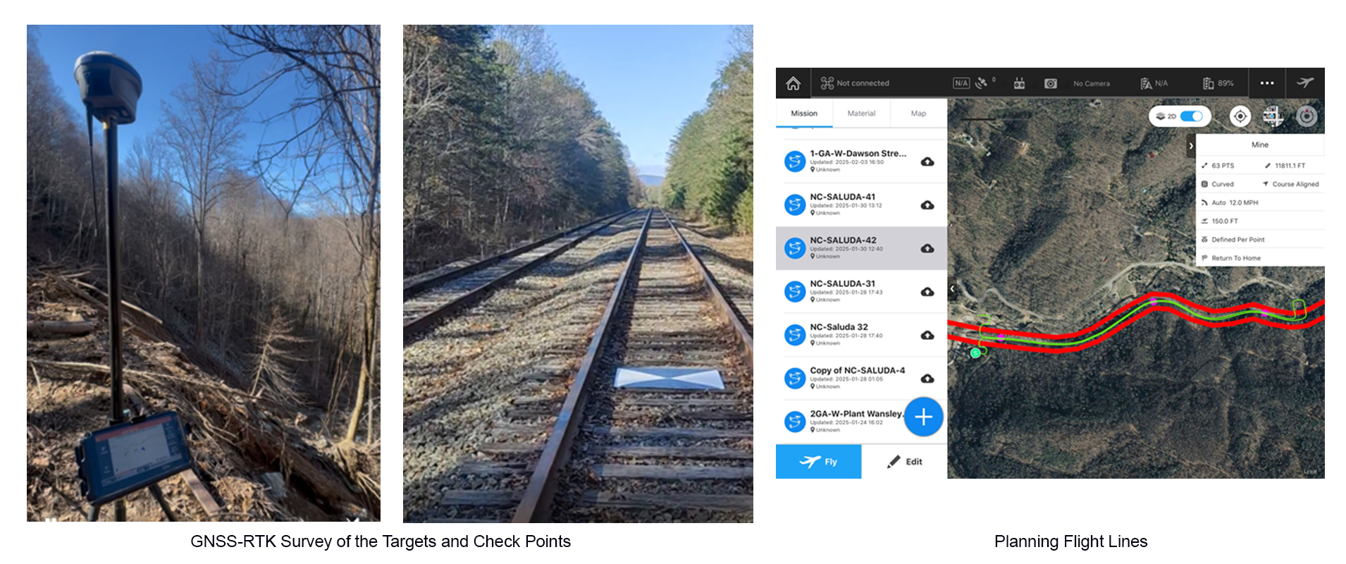
We tried to place targets every 2000 feet, as long as terrain irregularities and weather allowed, and checkpoints every 1000 feet for the final Quality Control and Quality Accuracy. They were measured with GNSS-RTK.
We used the USGS DTM and geospatial tools to divide the flight lines into 1.2-mile round-trip sections to ensure good LiDAR data within the 200-foot corridor, especially given significant slope changes over short distances of a few feet. We also used fly-follow-up routines with the car for test flights (DJI Phantom 4 Pro) and with the ortho captures (DJI Mavic 3E) because there were no safe areas to place the manlift in hurricane-ravaged regions (a few miles) or in high-topographic-relief areas.
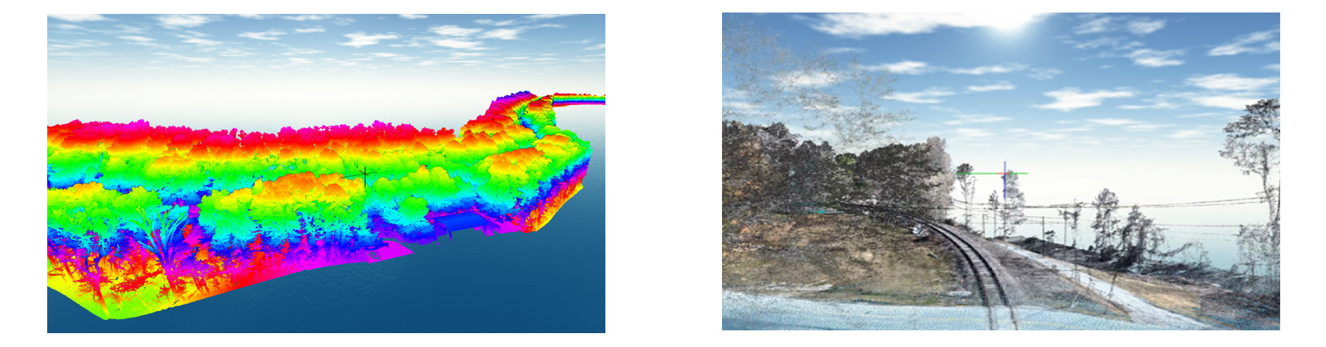
Once the test flight and ortho capture were completed, we safely captured LiDAR data with the DJI M600 PRO and the LIDARUSA Surveyor32 payload.
We used state-of-the-art UAS LiDAR technology to map 31.5 miles of a 200-foot-wide corridor, totaling 737 acres, collected across counties in North and South Carolina.
At the same time, we used UAS Photogrammetric technology to generate Georeferenced high-resolution orthomosaics with a GSD of less than 1.5 inches over the project's 31.5 miles.
GNSS-RTK surveys were used for quality control and accuracy of the delivered geospatial products, meeting the standards of the Land survey and mapping of each state, as well as those of the ASPRS.
Due to challenging terrain in some areas of these 31.5 miles, our expert staff combined geospatial analysis and remote sensing techniques to accurately plan flight lines and collect all data safely, maintaining the integrity of the geospatial products delivered to the client with high accuracy.
The geospatial products helped to map, design, and plan the new SALUDA GRADE TRAIL NC-SC"